Monday morning we started for home, the long way around. This time we went out I-80 across the Bay Bridge for Oakland and Sack o’ Tomatoes. Driving on the interstate felt novel, given how many non-interstate highways we’d driven over on this trip.
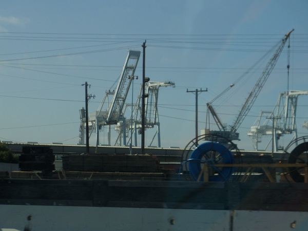
Cranes for unloading container ships at the Port of Oakland. This is what they use to load up all the incredible long trains of containers that we saw going east as we drove west.
At Sacramento, we got off I-80 and onto US Highway 50, where we saw a highway mileage sign telling us it was 3,073 miles to Ocean City, Maryland. You know, just in case we were going there. But since we weren’t, we went toward Carson City.
After Sacramento, we drove. We drove and drove and drove, and then we drove some more. And then for a change, we drove. We got to Carson City in time for a really late lunch.
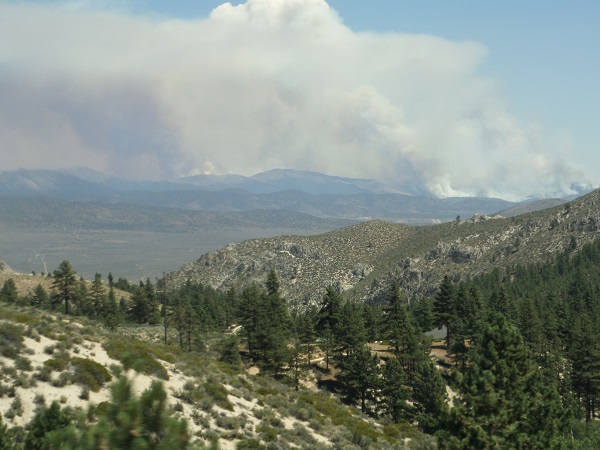
As we came in from the west, we saw at least three forest fires burning south of town, their plumes rising up and joining into a gigantic cloud in the stratosphere. We asked at the restaurant whether we were likely to run into any fires going east, but they said they didn’t think we would, and we didn’t.
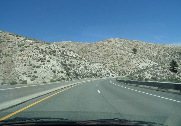
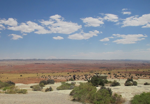
Nevada desert is some of the most desolate country in the world, outside of maybe the Sahara. Even tumbleweeds have to struggle to grow here, and there’s practically nowhere a tumbleweed can’t grow. As you can see, there’s the occasional juniper that manages to hang on, but they’re so rare I think the few inhabitants give them names. “Look, Ma, there’s little Eddie done grown half an inch since five years ago.” “You’re right, Pa, pretty soon he’ll be so big we won’t know him.”
Life magazine once called US 50 through Nevada and western Utah “the loneliest road in America,” and with reason. Spots the mapmakers deemed worth marking come about every fifty miles, and “worth marking” appears to mean “two buildings and a parking lot.” The road is also known as the Lincoln Highway, as it follows the route of the first real transcontinental highway through the state.
One thing US 50 has is a lot of mountains. Between Fallon and the Utah state line we climbed over seven summits or passes over six thousand feet, one of them almost eight thousand. We knew this would be the case, so L drove so I could quietly panic without having to drive at the same time. There were also very few guardrails, like almost none, although we didn’t find out why this was until we got to Colorado.
The only three places beyond Fallon that I thought deserved the name of settlement were Austin, Eureka, and Ely. Austin was maybe a dozen buildings, and several impressive collections of automotive and farming junk.
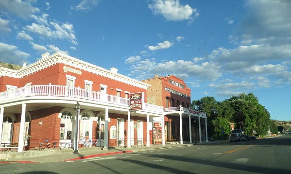
Eureka at least had a proper main street, and some buildings that hinted at more prosperous days as a silver mining community. Beyond that it was more hills and more highways run along the side of precipitous grades, all the way to Ely, where we stopped for the night as being about halfway to Durango.
Friday we got into Utah, and the spectacular painted deserts. (Another thing US 50 has a lot of is straight lines. On one reach leading into Hinckley, Utah, L drove 22 miles by the mile markers without having to turn the steering wheel.) We abandoned 50, and its fellow traveler I-70, after Green River, and turned south down US 191 toward southern Colorado. There was still lots and lots of empty land available, but now we occasionally got tourist towns like Moab, which is a favorite of white-water rafters.
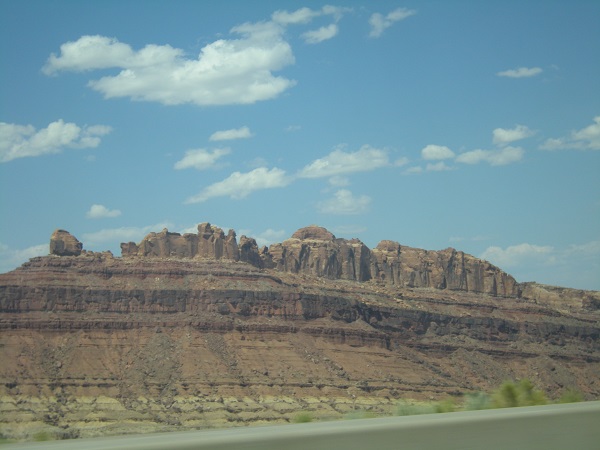
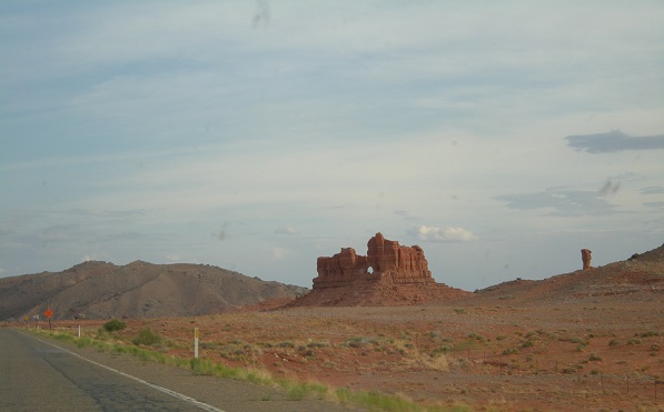
There were tons of dramatic mesas and cathedral formations.
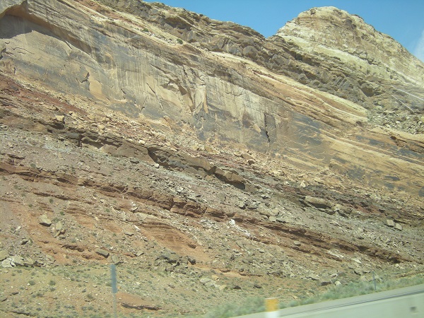
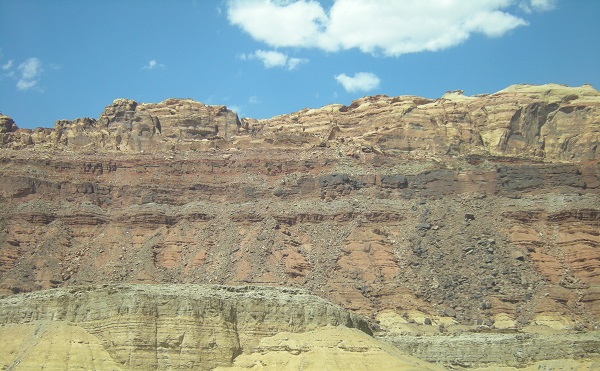
There were also places where the rocks were not just being worn away; they show new rock being born, like this uplift.
And then there was the sheer emptiness, like this salt flat somewhere in the Uinta Basin, thirty miles or so of red dirt and salt pans.
And there were window formations, like this one north of Teec Nos Pos.
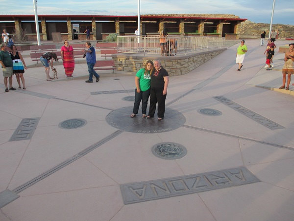
Tuesday M decided she wanted to go see Four Corners, so we changed our route and instead of turning east at Monticello, Utah to go to Cortez, we continued south to Blanding and then down into the very top of Arizona to meet US 160 and Teec Nos Pos, then swooped back northeast and reached Four Corners monument ten minutes before closing time, just long enough to take a picture and go again. M didn’t want to be in the picture, but L told her that Daddy had driven a hundred miles out of the way and broken a number of speed limits to get her there in time, and she could damn well come and be in the picture, so she was.
We got out a few minutes after eight and started up toward Durango. At Cortez, about forty miles away, I pointed out that we better get something to eat soon because all the restaurants in little towns like to close up early, and if we didn’t get something soon we might not get anything at all. M seconded this and L, sensing mutiny, agreed to stop and eat in Cortez. While we were eating, it got dark outside so L had to do the whole stretch from Cortez to Durango in the dark and with not very many road reflectors to guide her. What with no reflectors and no idea what the shoulders (if any) might look like, she took it all at about 45, which meant traffic built up behind her waiting for passing lanes. We only got honked at once, but several people did rather blast by us.
We got into Durango around ten-thirty, managed to find the hotel, and fell into bed except for me; I stayed up, wrote a day’s entry, and read LiveJournal, Dreamwidth and RSS feed until midnight.
2 Responses to Go west, young man: 2013 vacation, Days 10 and 11